
Contact Laura Uribe
Schedule A Showing
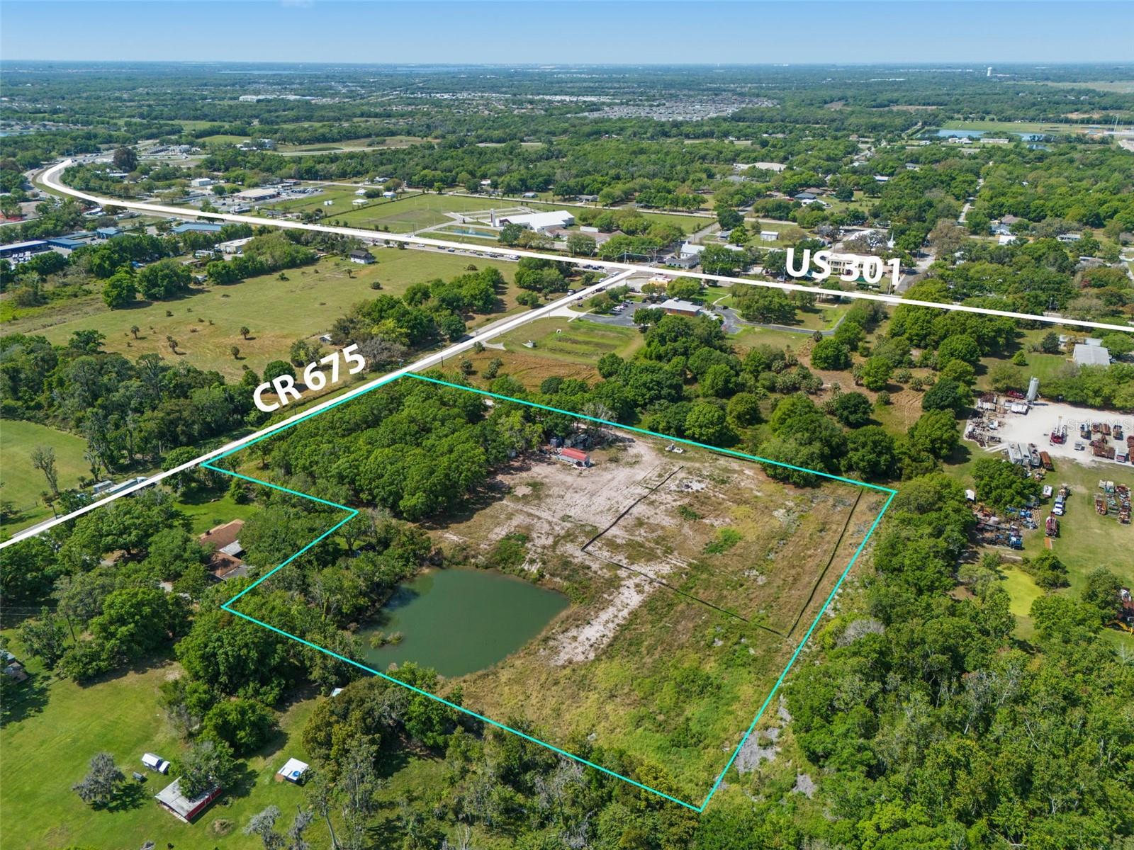
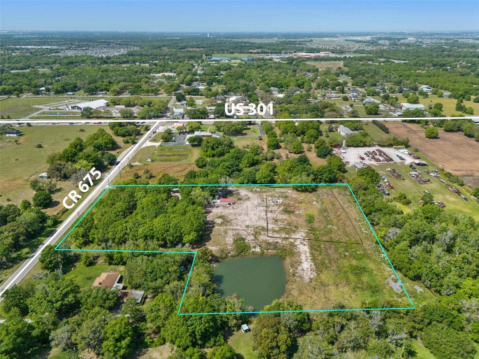
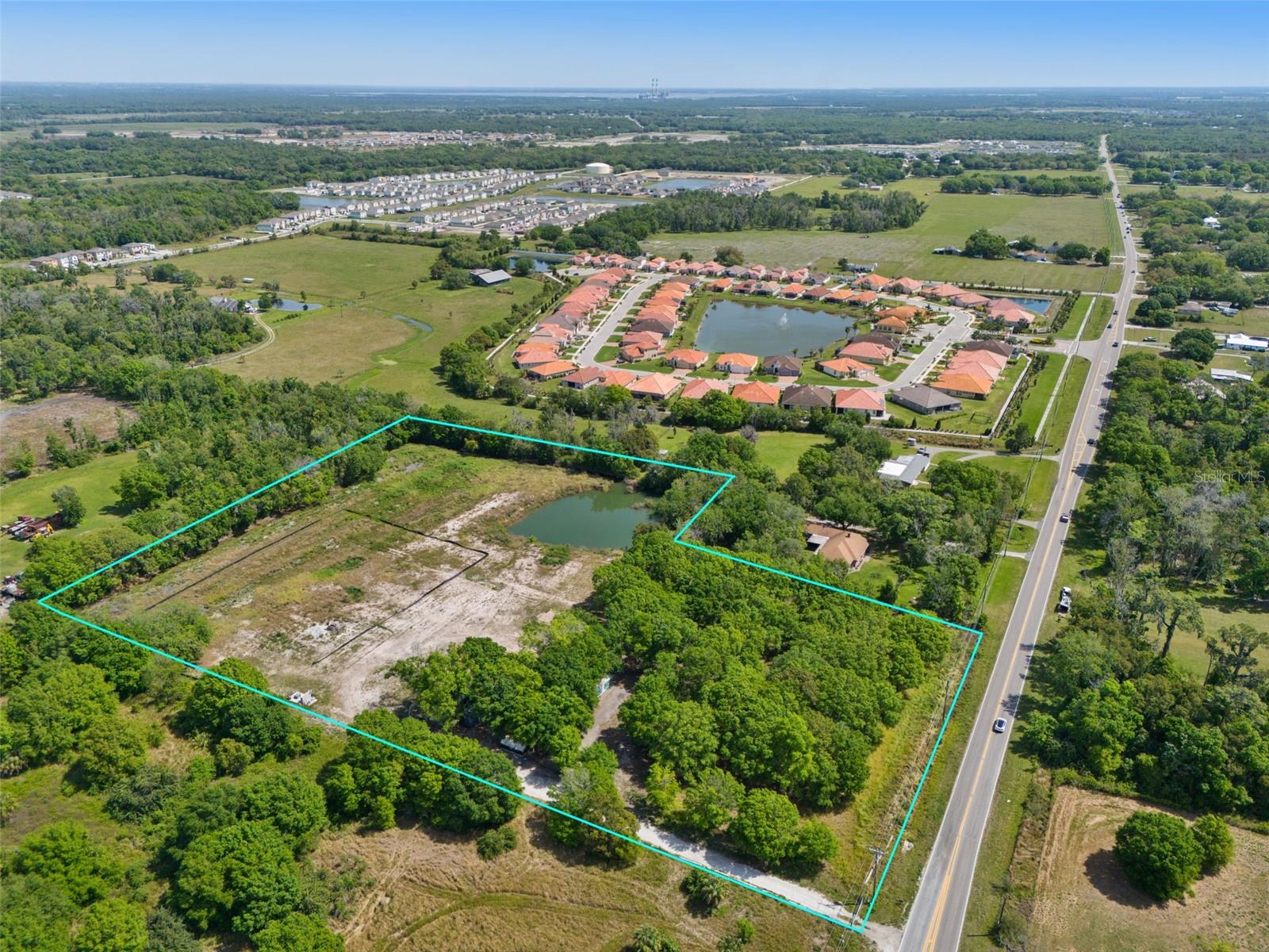
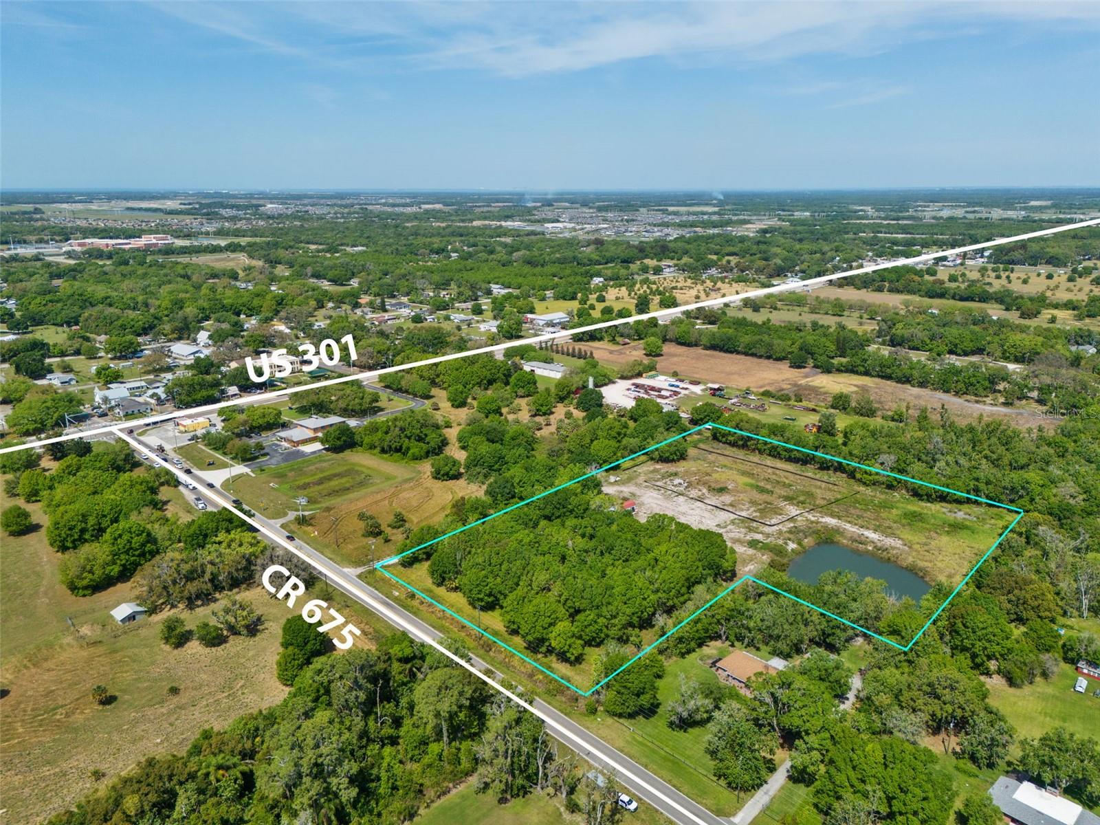
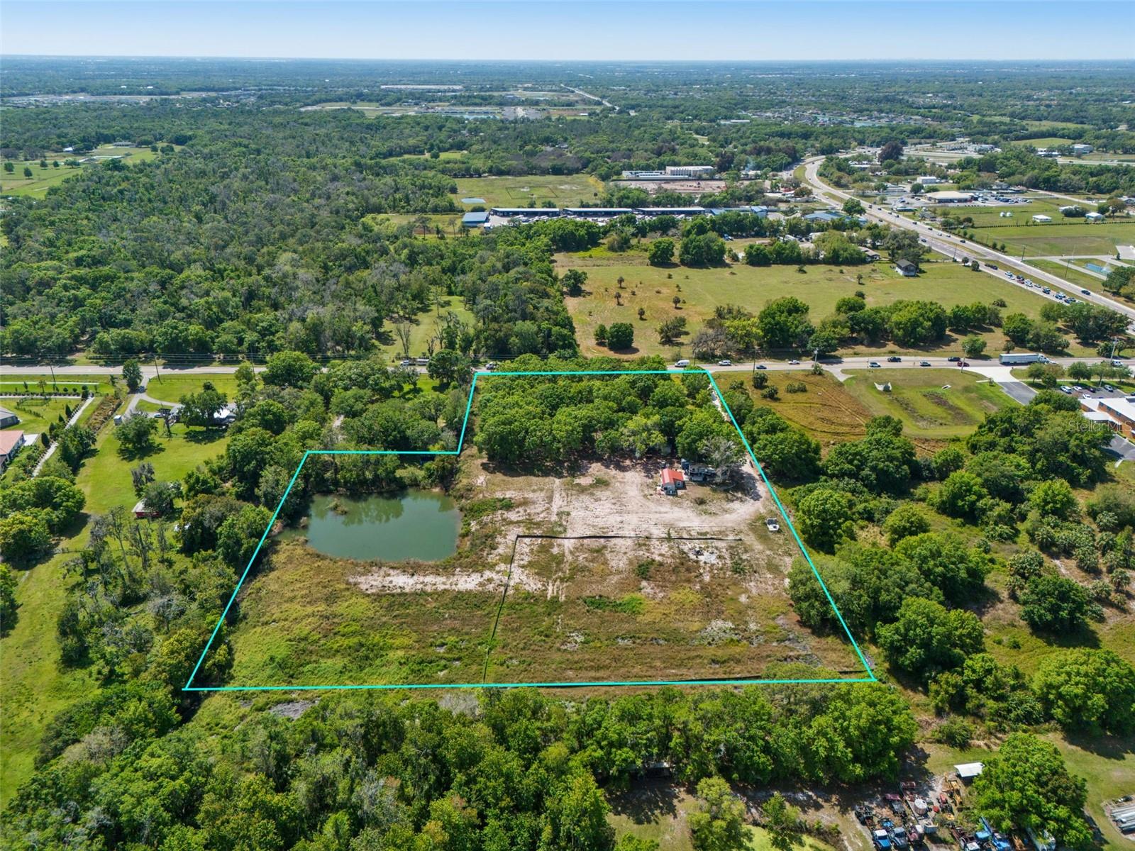
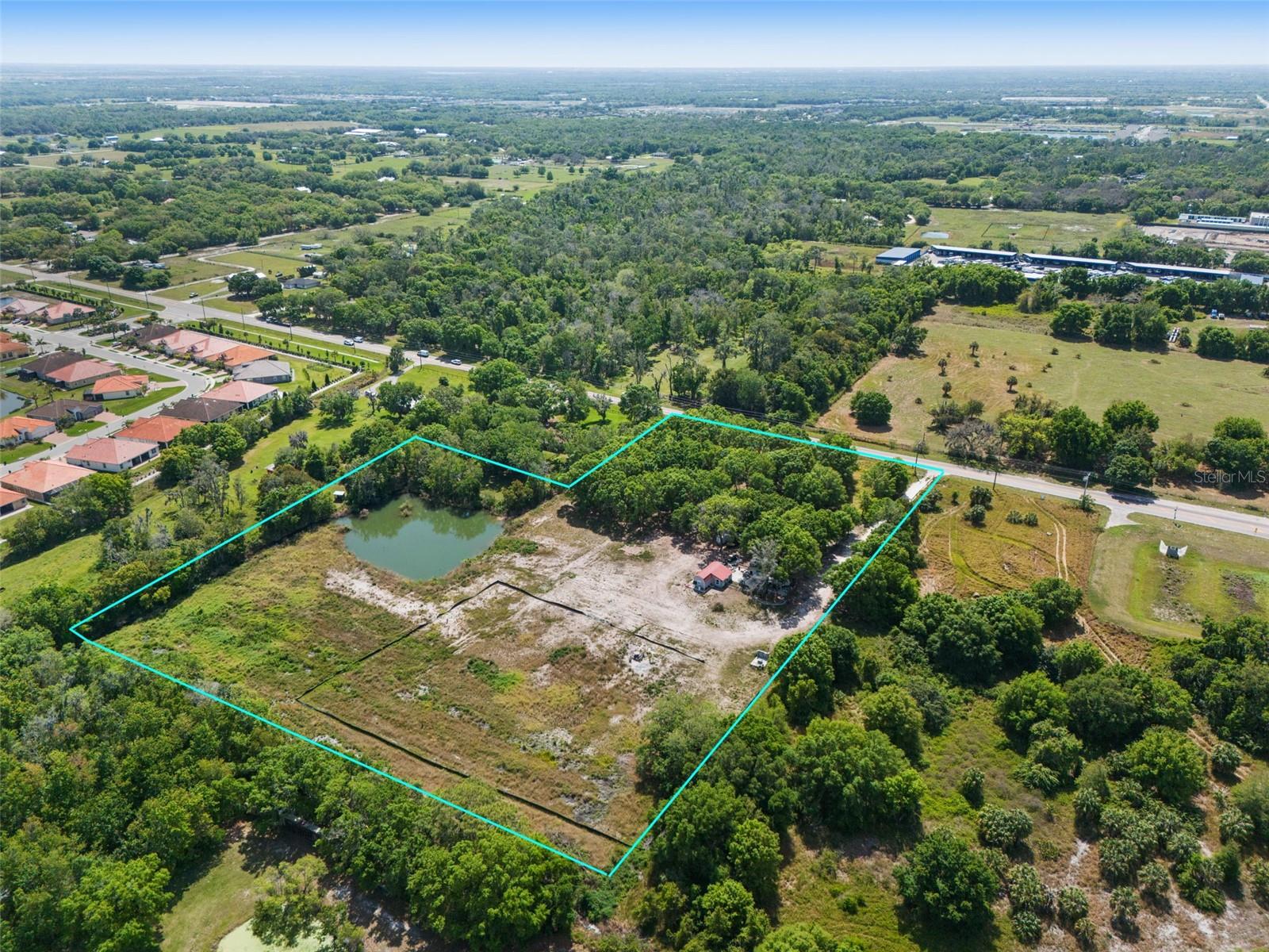
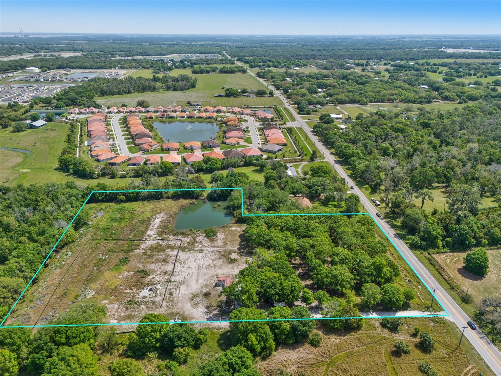
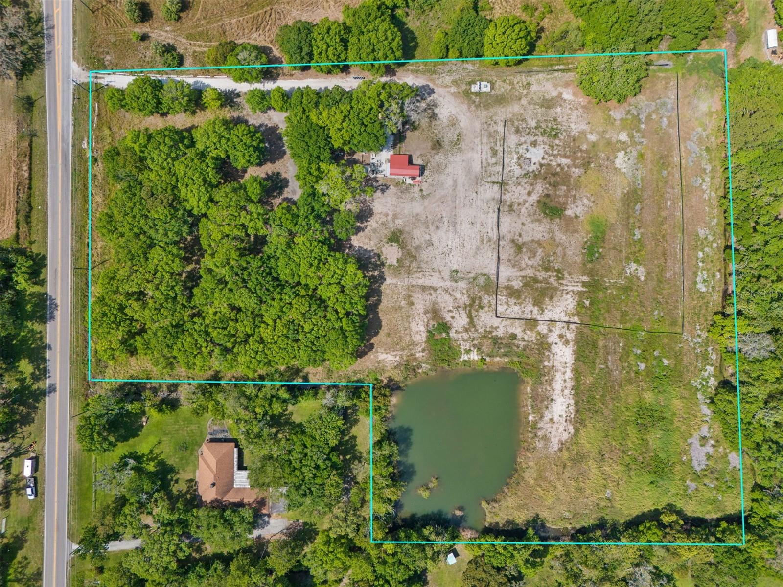
12250 County Road 675, PARRISH, FL 34219
Priced at Only: $1,500,000
For more Information Call
Office: 855.844.5200
Address: 12250 County Road 675, PARRISH, FL 34219


Property Location and Similar Properties

- MLS#: A4603920 ( Land )
- Street Address: 12250 County Road 675
- Viewed: 10
- Price: $1,500,000
- Price sqft: $0
- Waterfront: No
- Year Built: Not Available
- Bldg sqft: 0
- Days On Market: 346
- Acreage: 7.17 acres
- Additional Information
- Geolocation: 27.5773 / -82.4223
- County: MANATEE
- City: PARRISH
- Zipcode: 34219
- Provided by: MCGREGOR INTERNATIONAL REAL ESTATE CO
- Contact: Warren McGregor
- 941-363-1210

- DMCA Notice
-
Description*** PRICE IMPROVEMENT*** Incredible Parrish Land Opportunity*** 7.1 Acres directly on CR 675 and one lot in from US 301. So many possibilities with Commercial, SFR and Multi Family communities around this property and directly next to vacant land that has been rezoned for commercial development. Future Land Use of this property is UF 3 (Urban Fringe 3) uses include: Neighborhood & community commercial, Low density residential, Medium density clustered residential, Public/semi public, recreation & schools. The current owner intended to build a 7700 sqft home that is site ready with a 380ft fresh water well, 400 amp Electric service and a man made pond for serenity. Survey, Building Plans and Soil Reports available. There is both county Water and Sewer available on CR 675. Parrish and the 301 corridor where this property is located in the path of growth of the 6th fastest growing metro in the USA that connects Sarasota / Manatee county with Hillsborough County.
Features
Home Owners Association Fee
- 0.00
Carport Spaces
- 0.00
Close Date
- 0000-00-00
Country
- US
Covered Spaces
- 0.00
Current Use
- Agricultural
Garage Spaces
- 0.00
Legal Description
- THE E 540 FT OF S1/2 OF NW1/4 OF SE1/4 & THE E 540 FT OF S 86 FT OF N1/2 OF NW1/4 OF SE1/4 SEC 29
- SUBJ TO R/W OFF THE S FOR SR 675
- LESS THAT PART OF THE ABOVE DESC PARCEL AS DESC IN: BEG AT THE SE COR OF THE NW1/4 OF THE SE1/4
- GO W 209 FT
- TH NLY 314 FT
- TH ELY 209 FT
- TH SLY 314 FT TO THE POB (688/636)
- (1441/1505) PI#4645.1100/5
Living Area
- 0.00
Area Major
- 34219 - Parrish
Net Operating Income
- 0.00
Parcel Number
- 464511005
Property Type
- Land
Sewer
- Septic Tank
Tax Year
- 2023
Township
- 33
Utilities
- Electricity Available
Views
- 10
Virtual Tour Url
- https://www.propertypanorama.com/instaview/stellar/A4603920
Water Source
- Well
Zoning Code
- A1